Built for network operators and network owners

Build thenetwork-wide3D twin.Capture onlywhat matters.

ConVis turns existing customer data into a network-wide operational 3D twin. Spatial Data Capture creates missing spatial detail from available plans and documentation wherever possible, then captures only the remaining, decision-relevant gaps.

Anonymized first demo · no customer data or system access required.

Explore ConVis

ConVis + Spatial Data Capture

One platform. One shared spatial data layer.

ConVis starts with existing customer data rather than assuming everything must be captured again. Available records, plans and documentation are turned into an operational 3D context; missing spatial information is created from existing source material where possible and captured only where required.

ConVis platform

Operationalize the data already available.

Available site, asset, topology, plan and documentation data become a shared spatial workspace for RF review, planning, validation, acceptance and handover.

  • Start with customer data before new capture begins.
  • Keep the resulting spatial context reusable across teams and workflows.

Spatial Data Capture

Complete only the missing spatial detail.

Where relevant geometry or site detail is absent, available plans and source material are converted into usable spatial data first. Targeted capture is added only when the intended workflow requires more.

  • Prepare spatial data from existing source material wherever possible.
  • Capture only the remaining, decision-relevant gaps.
Existing data first. Targeted enrichment second.

Use what is already available. Convert existing source material into usable spatial data. Capture only the remaining gaps. Keep every validated addition reusable in the shared layer.

Value logic

A shared spatial layer improves decisions, rollout scale and automation.

Network operators often already have useful records. ConVis makes them spatially accessible, exposes gaps and adds precision only where the target workflow requires it. The result is better review quality, scalable reuse and a structured basis for workflows and automations.

Shared context

One reviewable spatial context.

Records, drawings and evidence become accessible in one shared 3D context so teams evaluate the same spatial situation.

Cross-team review

Decision quality

Precision follows decision impact.

RF coverage, feasibility, validation and handover improve where representation is fit for the target workflow.

Fit-for-purpose precision

Network scale

Reuse before recapture.

Existing data, plans and remote methods form the network-wide starting point; new capture focuses on decision-relevant gaps.

Network-wide reuse

Automation

Structure makes logic repeatable.

Consistent spatial data supports repeatable QA, validation and customer-specific workflows and automations.

Compounding automation

The relevant value mix depends on the operator, data situation, target workflow and rollout stage. Automation often carries the largest long-term potential and compounds as formats, rules and workflows become repeatable.

Implementation flow

Start with a network-wide base twin. Add precision where required.

Existing network records create the network-wide starting point. A workflow-specific data and confidence check shows what can be used immediately and where uncertainty affects a decision. Only those gaps trigger targeted spatial capture; validated updates return to the shared ConVis twin.

Build the network-wide base twin
Enrich only where decisions require it

01 · Existing data

Start from available records.

Topology, sites, assets, plans, mast documentation and location data form the starting point.

02 · Network-wide base twin

Create the shared operating context.

Existing records become a functional 3D context across the network before broad new capture begins.

03 · Data u0026 confidence check

Test fitness for the target workflow.

Review what is usable now, what remains uncertain and which gaps affect the decision.

Use the base twin now

Begin review without new capture.

Where available detail is sufficient, planning, validation and review can start immediately.

04 · Targeted spatial capture

Close only the relevant gaps.

Use plan conversion, remote digitization, targeted measurement or selective scans.

05 · Validate u0026 return

Keep accepted updates reusable.

Validated updates, evidence and agreed outputs return to the shared twin or customer systems.

05 returns to 02. Validated updates become part of the network-wide base twin.

Build the network-wide base twin

01 · Existing data

Start from available records.

Topology, sites, assets, plans, documentation and location data.

02 · Network-wide base twin

Create the shared operating context.

Functional 3D context before broad new capture begins.

03 · Data u0026 confidence check

What does the target workflow require?

Review what is usable, what is uncertain and what affects the decision.

Enrich only where decisions require it

Usable for the workflow

Use the base twin now.

Review, planning and validation can begin without new capture.

or

Decision-relevant gap

04 · Targeted spatial capture

Plans, remote digitization, measurement or selective scans.

05 · Validate u0026 return

Accepted updates return to the shared twin or customer systems.

The base twin remains the shared layer.
ConVis workflows u0026 automations

RF coverage, planning and automation in one spatial context.

ConVis already supports workflows and automations for RF review, visibility checks, planning context, fiber routes, acceptance loops, indoor assets and site-specific analysis. Because every operator has its own data structures, rules and operational constraints, ConVis adapts these capabilities to the customer environment.

Supported today

Already available in ConVis.

All listed workflows and automations are already supported. The library shows available capabilities, not a future roadmap.

Problem-led workflows u0026 automations

Start from the real network problem.

Customers can bring a concrete requirement or an operational problem. Glaucus translates it into practical workflows, checks and automation logic.

Integrated by design

Adapted to the customer environment.

Data structures, technical rules, toolchains and acceptance processes are mapped into the way the workflow is delivered.

Featured workflows u0026 automations

Explore more workflows u0026 automations

Filter the library or scroll horizontally. Every card represents a supported capability.

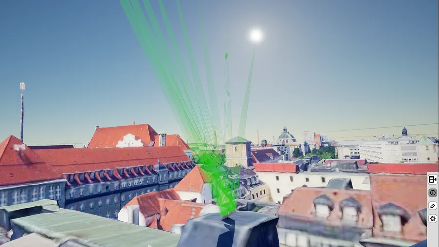
Reachability check in ConVis

Reachability

Reachability checks.

Review access, mounting positions, maintainability and site constraints before a team goes on site.

Network planning context in ConVis

Planning

Planning context.

Use visual context, vLOS and reachability to plan more efficiently and structure rules for customer-specific planning automation.

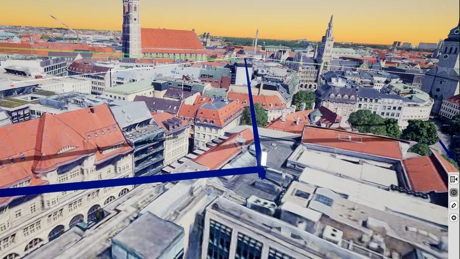
Data-based fiber route represented precisely in the shared ConVis 3D context

Network data

Fiber routes.

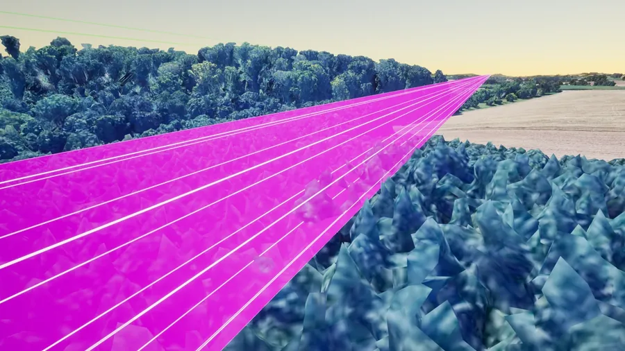
Represent fiber routes precisely from available network data, keeping physical paths and network relationships reviewable in the shared 3D context.

Logical network connections visualized in ConVis

Routing

Logical connections.

Visualize routing, link relationships and network logic directly in the shared 3D context.

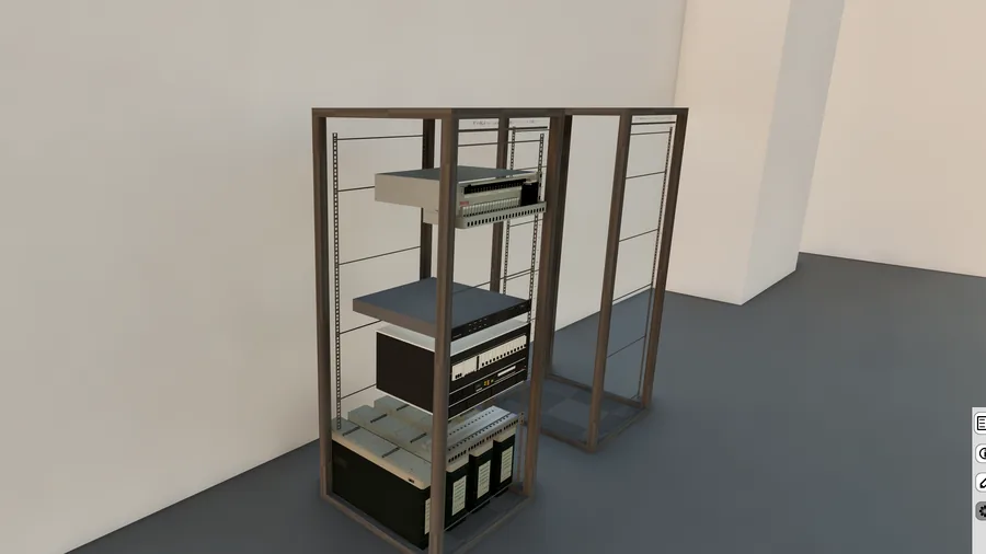
Technical room, racks and assets in ConVis

Indoor u0026 assets

Rooms, racks and assets.

Map technical rooms, cabinets, racks and asset-to-location relationships where they affect rollout or validation.

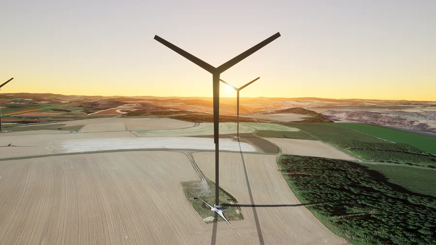
Site-specific obstacle layer in ConVis

Site context

Custom obstacles.

Review wind turbines, cranes and other national or project-specific obstacle layers in the same spatial workflow.

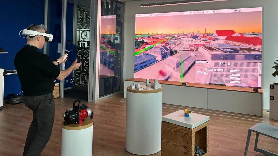
ConVis VR live demonstration in the InnovationArea in Munich

VR · Live showcase

VR review.

Use immersive ConVis review for planning, training or stakeholder alignment — demonstrated live in the InnovationArea in Munich.

Solar and shadow analysis in ConVis

Solar

Solar analysis.

Assess solar potential and shadow context in a dedicated site-analysis workflow where relevant.

Swipe to explore more workflows

Spatial Data Capture

Existing data first. Increased precision only where decisions require it.

The capture model is built for efficient rollout: reuse existing records, plans and source material first, digitize remotely where possible and capture precise spatial data only where reality changes the decision. Selective scans remain available for complex cases, but they are not the default starting point.

01 Scalable base

Existing records and plans

02 Efficient remote methods

Remote digitization where possible

03 Decision-critical

Targeted reality where required

04 Update loop

Accepted updates return

Scale u0026 remote preparation

Existing network data transformed into a ConVis twin

Scalable base

Existing data transformation

Existing network data can create the network-wide ConVis twin first. Topology, sites, assets, plans and location data form the starting layer before new capture work is scoped.

Plan-based spatial conversion into a structured 3D context

Efficient remote methods

Plan-based spatial conversion

Approved 2D plans, drawings, rooms, racks and position indications are converted into structured spatial data that can be reviewed and reused inside ConVis.

Remote mast digitization in ConVis

Efficient remote methods

Remote mast digitization

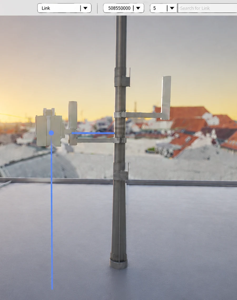
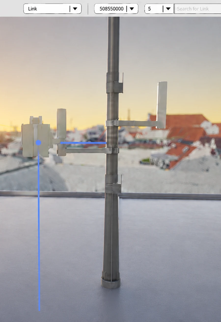
Where source quality is sufficient, essential mast elements are digitized remotely into fit-for-purpose 3D models for efficient rollout cases.

Increase precision where needed

Swipe through remote and decision-critical capture methods.

Decision-critical precision u0026 accepted state

Targeted on-site measurement for network infrastructure

Decision-critical

Targeted on-site measurement

When reality changes the decision, teams capture only relevant elements: azimuth, height, coordinates, offsets, photos or completion evidence.

Selective scan for a complex network site

Decision-critical

Selective scans

Scans remain available for complex sites, customer requirements or cases where dense geometry is truly valuable — but they are not the default rollout method.

Acceptance update loop from planned target through measured as-built evidence to an accepted reusable update

Update loop

Acceptance update loop

Planned targets, installer evidence and measured reality are compared. Accepted as-built updates return to ConVis or agreed customer systems.

Capture automation path

Deliver now. Increase automation continuously.

ConVis spatial data capture is designed to deliver usable output today from existing customer material. Based on customer needs, Glaucus has specialized in PDF-based digitization, while CAD and other structured source formats can also be supported where available. The current delivery model is partly automated and expert-guided; automation reduces repetitive work, supports checks and prepares outputs while customer-specific material remains controlled.

Deliver now

Efficient source-based delivery.

Source-based delivery

Existing customer material such as PDFs, CAD files, plans and structured records can become usable spatial data without starting every case with full field capture.

Automation-supported remote production

Automation, checks and workflow tooling reduce repetitive work so expert effort focuses where source ambiguity or customer-specific judgment matters.

Increase automation continuously

More structured inputs, more reusable automation logic.

Repeatable customer logic

Customer formats, naming conventions, acceptance criteria and output requirements are translated into repeatable delivery logic.

Increasing automation

Where inputs and rules become stable, conversion, QA and output preparation can be automated further for faster and more scalable delivery.

Automation increases where formats, rules and acceptance criteria repeat.

Source material Spatial data QA u0026 acceptance Output preparation

Proof of Value

Prove the rollout logic on a focused sample.

A ConVis Proof of Value starts with a representative area, available customer material or an operational network problem. It demonstrates the approach in a realistic customer context, exposes assumptions early and creates the evidence needed to decide whether — and how — the rollout should continue.

01

Scope the sample

Define the proof question.

Define the representative area, source material, target use case and acceptance questions the PoV should answer.

02

Build the sample twin

Create a bounded working model.

Transform available material into a ConVis sample twin and make gaps and assumptions visible.

03

Validate the approach

Test the approach against the use case.

Review the relevant workflows, data assumptions and acceptance criteria on the sample.

04

Decide the next step

Make an evidence-based decision.

Compare demonstrated value, remaining assumptions and implementation effort before committing to a broader rollout.

Next step

Start with a guided ConVis demo.

See ConVis in an anonymized environment and discuss the workflow or data problem that matters most. The first conversation is adapted to your current stage — from a focused product walkthrough to a customer data check or initial PoV scoping.

No customer data or system access is required for the first demo. Any later data, security or access scope is agreed explicitly.

Book guided demo call

Anonymized demo · no customer data required

What the first call covers

01

See ConVis in context

An anonymized product environment with representative workflows and realistic review examples.

02

Discuss fit and constraints

Relevant workflows, available source material, integration and security boundaries.

03

Agree the useful next step

A follow-up, customer data check or focused PoV scoping — depending on the current stage.